5 Must-Have Map Data Processing Tools for 2025
Free on-premise cesium ion alternative
With the acceleration of digital twin and smart city development, efficient map processing tools have become an industry imperative. This article focuses on six map processing software programs that combine functionality and practicality.
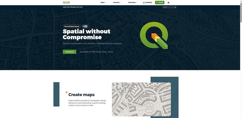
1. QGIS (Open Source)
Main Values:
Over 2,000 plugins support the entire process, from remote sensing image classification to heat map analysis.
Built-in GRASS tool library, ensuring high hydrological simulation accuracy.
Target Audience: University research teams, small and medium-sized GIS projects.
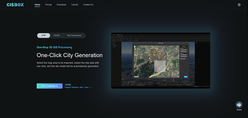
2. GISBox (A Powerful 3D GIS Data Processing Tool)
Core Advantages:
Seamless Multi-Format Conversion: Supports conversion between multiple formats, including OSGiB and 3D Tiles, and accurately repairs oblique photography model cracks.
Zero-Code Real-Time Editing: Complete model calibration in 10 seconds using riverbed depression and terrain alignment features, which traditionally would take hours.
Free Service Release: Supports importing raster or vector data, automatically generates 3D Tiles/WMTS service addresses, and directly connects to visualization platforms such as Shanhaijing.
Applicable Scenarios: BIM-GIS integration, emergency 3D modeling, and digital twin foundation development.
3. Manifold GIS (Spatial Computing Engine)
Core Functions: Integrates GIS, CAD, and databases, supports querying millions of features in seconds, and is natively compatible with BIM models.
Typical Applications: Intelligent urban pipeline operation and maintenance, spatial analysis of commercial site selection.

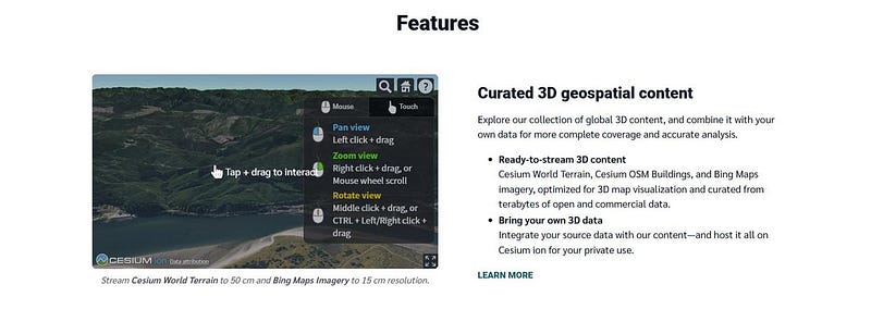
4. Cesium ion (3D Geospatial Cloud Platform)
Technical Breakthroughs:
Supports streaming loading of terabyte-scale 3D Tiles, enabling real-time rendering of global terrain data with latency below 200ms.
Built-in cinematic special effects such as sun shadow calculation and dynamic weather simulation.
Application Scenarios: Digital twin cities, space mission visualization.
5. ArcGIS
Core Functions:
Integrated LiDAR point cloud processing tools, supporting TIN surface modeling and 3D spatial analysis.
Real-time 3D data stream processing (latency < 1 second) through the GeoEvent Processor.
Seamlessly integrated with BIM models, applied to the Hong Kong-Zhuhai-Macao Bridge operation and maintenance system.
Advantages: Large-scale project management, emergency response.

In summary, from open source ecosystems to professional platforms, the above-mentioned map processing tools, with their differentiated technical approaches and scenario adaptability, provide end-to-end solutions for digital twin construction, project operations, scientific research, and analysis. Users can choose the appropriate tool based on project requirements (such as data size, 3D modeling accuracy, and budget). In the future, with the integration of spatial computing and artificial intelligence technologies, map processing software will achieve deeper breakthroughs in real-time rendering, intelligent analysis, and other areas, continuously empowering the development of smart cities.
GISBox Official Teams: https://teams.live.com/l/invite/FEAr12sInvEVy4hFQE
Official Teams Group: https://teams.live.com/l/invite/FBAFp0pbqhqlpe1BQI
Contact us to get 7-day Team Plan


评论
发表评论